GIS Cloud Suite
Use Geometry Service
Users support to use Geometry Service on the web page or by API, please follow the steps to enter the web page of Geometry Service:
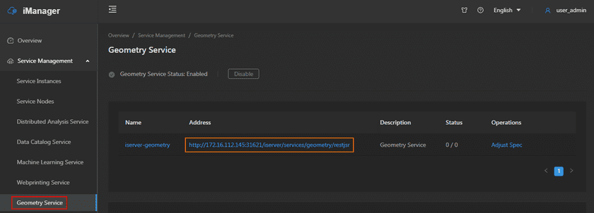
- On the management page of GIS Cloud Suite, clicks on Service Management > Geometry Service.
-
Clicks on Enable and confirm and select wether run on demand as a funcion;
Enable/disable run as a function on-demand . If enabled, node scaling configuration is required:
- Scaling Mode: Dynamic scaling mode is used by default.
- Monitoring Type: Supports selecting Concurrency or RPS (requests per second).
- Threshold: The parameter corresponding to the monitoring type selected by the user.
- Minimum Node(s): The minimum number of nodes in the scalable range set by the user.
- Maximum Node(s): The maximum number of nodes in the scalable range set by the use.
- Wait for the Status change to “1/1”, then Geometry Service is ready to use;
-
Clicks on the link under the Address to enter the Geometry Service interface.
Notes:
The method of how to use Geometry Service please refer to SuperMap iServer Documentation.
